Stream Restoration

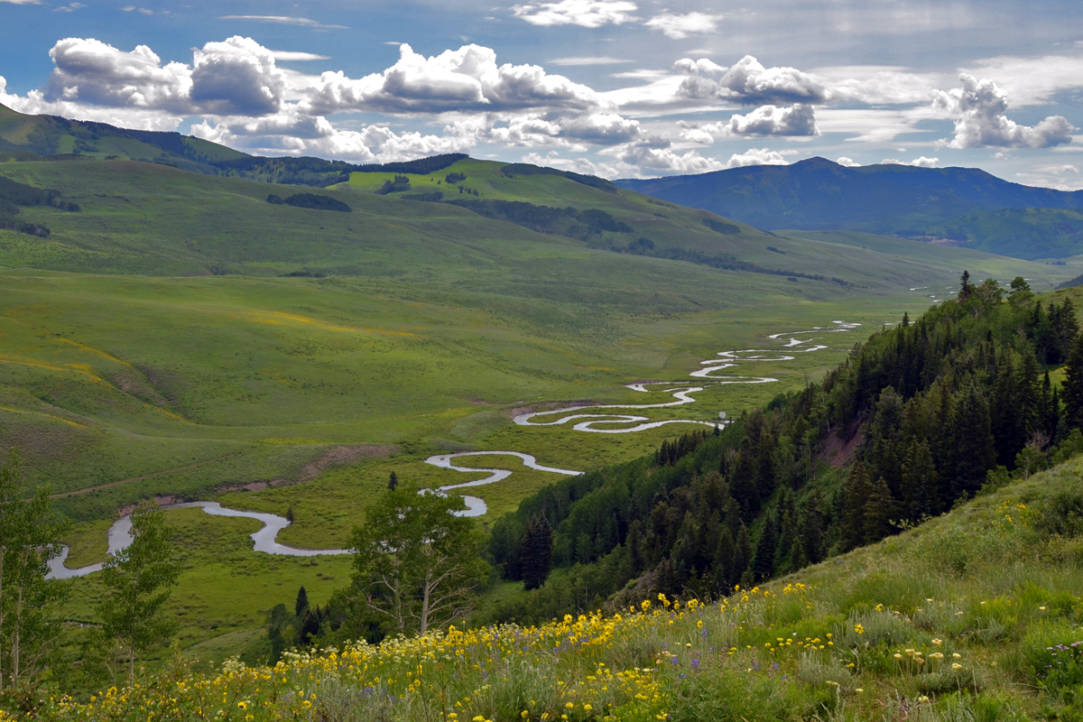
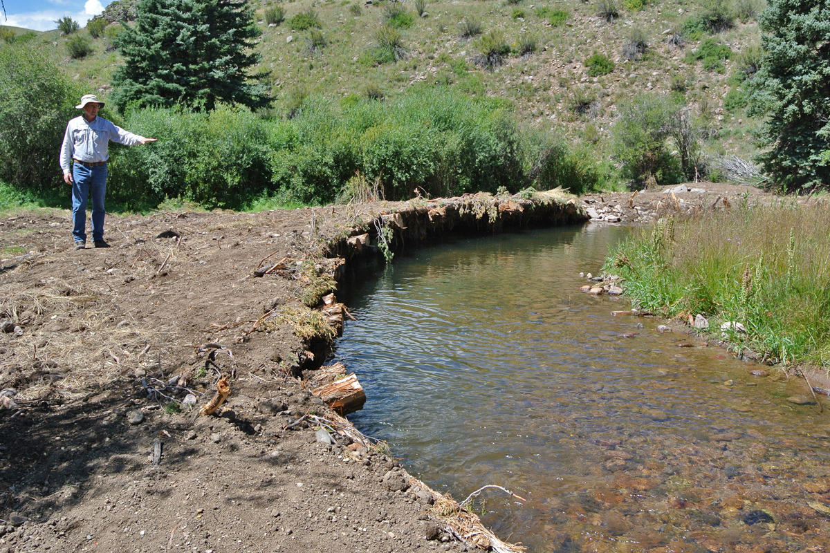
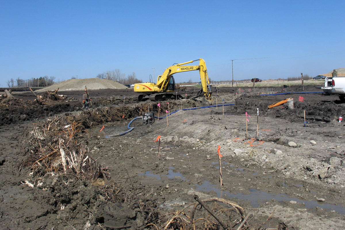
Birch Ecology understands that successful stream restoration projects are a product of expert design and implementation that encompasses engineering, hydrology, stream morphology, and habitat restoration.  The ultimate goal of stream restoration is to improve water quality, in-stream habitat, and riparian function such that the biotic and morphological integrity of the stream are improved and maintained.  Success is a function of assembling the right team to ensure each component is properly designed and constructed.

Birch Ecology’s team includes well-respected experts in stream restoration and enhancement that will provide an experienced perspective on the best approach to achieve your project goals.  We have assembled a group of ecologists, stream hydrologists, aquatic biologists, engineers, construction crews, and wetland experts that can manage a project from start to finish.

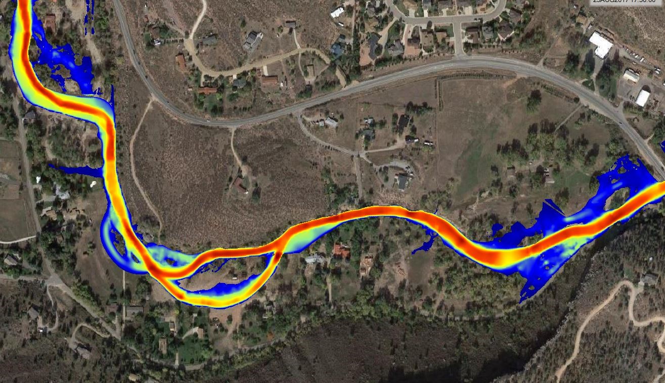
Key members of this team include S2O Design and Engineering from Lyons, Colorado and Black Creek Hydrology of Northglenn, Colorado.  S2O’s team of engineers has successfully restored miles of streams impacted by the 2013 floods in Colorado.  They are renowned for their expertise in hydraulic modeling and the design of hydraulic structures.  In addition, Black Creek Hydrology has over 35 years of stream channel experience including the assessment and/or restoration of over 100 rivers and streams, along with the design and construction oversight of nearly 40 miles of stream channel in Colorado, Missouri and Illinois.   Black Creek Hydrology’s emphasis is on natural channel design and morphological process-based methods and fisheries enhancements applied to streams and ponds.  These key associates compliment Birch Ecology’s expertise in wetland delineations, permitting, and restoration, resulting in a skilled multidisciplinary team.

STREAM ASSESSMENT

Stream assessments are critical for developing a baseline understanding of stream health and watershed conditions.  They provide an important foundation for developing restoration plans and for making informed land management decisions.  Our team of hydrologists, fluvial geomorphologists, ecologists and engineers are experts in stream assessments.  We prepare surveys of channel morphology, conduct sediment transport analyses, assess watershed conditions, and evaluate riparian and wetland plant communities to develop effective stream restoration and management plans.

Photo Credit: Jeremy A. Garcia

Measuring bedload and suspended sediment on Henson Creek. Photo Credit: Steve Belz

Dye tracer study on the Rio Grande River in the San Juan Mountains of Colorado. Photo Credit: Steve Belz

STREAM RESTORATION

Stream restoration approaches can vary depending on the degree of impairment, ecological setting, and project goals.  Restoration techniques can range from improved land management to active intervention to restore stream channel geomorphology, stabilize eroding banks, reconnect the floodplain, create riffles and in-stream features, improve diversion function, and revegetate and enhance the riparian and wetland plant communities.  Our team can deliver a holistic approach that gives the riparian and wetland communities the best opportunity to thrive, improving the ecological functioning of the riparian corridor.

The best stream restoration projects incorporate a multidisciplinary approach that utilizes the expertise of hydrologists, geomorphologists, engineers, ecologists and aquatic biologists.  Our team can deliver this expertise and has a track record of successful projects.

Restoration on the Poudre River using natural channel design methods and bioengineered stream banks. Photo Credit: Steve Belz

NATURAL CHANNEL DESIGN AND PROCESS-BASED METHODS

Our team has considerable expertise with natural channel design and process-based methods for stream restoration.  This design approach recognizes that a stream is a dynamic, complex system that includes not only the active channel but also the floodplain and the vegetation of the riparian corridor.  Understanding that streams are dynamic systems, natural channel design methods seek to mimic the natural processes that occur in healthy systems to restore their functions.  In contrast to traditional, engineered methods that stabilize problem areas with rip-rap and concrete, natural channel design is focused on restoring the processes that help move a stream back toward a more balanced state by understanding sediment transport and flow regime, then creating an appropriate geometry for the channel and floodplain while incorporating natural materials including boulders, toe wood and large woody debris, in-stream structures, and riparian vegetation.  Our multidisciplinary team has the technical expertise necessary to successfully implement these methods.

Natural channel design and stabilization incorporating large woody materials. Photo Credit: Steve Belz

BANK STABILIZATION

Our team utilizes a bioengineering approach for bank stabilization, incorporating engineering concepts with biological knowledge to design solutions to erosion and land stability problems.  Bioengineering uses both herbaceous and woody plants, logs, root wads, boulders, and other natural materials to aid in stabilizing and reducing erosion on streambanks, bringing together engineering and ecology to create long-term solutions to reduce risk from natural hazards.

Re-meandered stream using bioengineering techniques. Photo Credit: Steve Belz

RIPARIAN HABITAT RESTORATION AND ENHANCEMENT

Healthy riparian habitats are necessary to protect the functions and values of streams.  We specialize in restoring and creating wetlands and riparian habitats in a variety of stream types.  We utilize proven techniques to establish diverse plant communities that provide erosion protection, structural diversity, and increased wildlife habitat value.  We have the technical expertise to design appropriate seed mixes and planting plans based on the expected hydrology, elevation, and ecological condition.  We work onsite with heavy equipment operators and restoration crews to implement our designs, then provide monitoring and stewardship until the restoration success criteria are achieved.

Willow cuttings in a riparian wetland restoration along the South Platte River near Ft. Morgan, Colorado. Photo Credit: Steve Belz

FISHERIES ENHANCEMENTS

Our team has considerable expertise in the area of stream restoration for fisheries enhancements.  Steve Belz of Black Creek Hydrology has successfully restored and enhanced the fisheries on nearly 40 miles of private streams in Colorado, Missouri, and Illinois.  Through the establishment of proper pool-riffle bed form, oxygen-rich water, appropriate streambed substrate to support macroinvertebrates, riparian habitat with overhanging vegetation, and the installation of appropriate structure, Steve’s designs have produced incredible results for his clients.  Because many clients also desire ponds as part of their fisheries, Steve has designed and installed numerous ponds ranging in size from less than half an acre to over five acres.

Brook Trout (Salvelinus fontinalis). Photo Credit: Riley Adams

Bank stabilization incorporating a cedar log shelf and overhang to provide cover for fish.

RESTORATION IMPLEMENTATION & OVERSIGHT

Our ecologists, hydrologists, soil scientists, and engineers can manage a project from start to finish.  After the design phase, we prepare construction documents, then provide construction-phase services such as bidding, oversight, and inspection.  This full-service approach ensures that the project is delivered to design specifications and meets permit requirements.

Construction of a stream restoration with large woody materials on the outside channel bends. Photo Credit: Steve Belz

MONITORING

Monitoring and stewardship are important parts of any restoration project.  When required by the permitting authorities, we establish detailed monitoring programs for our stream restoration projects.  These include the establishment of monitoring cross-sections which are periodically surveyed to track changes in channel geomorphology, as well as quantitative vegetation monitoring transects for measuring plant cover, species diversity, and survivorship.  The results of these monitoring studies are used to evaluate the achievement of ecological performance standards and are included in annual monitoring reports submitted to the U.S. Army Corps of Engineers and other regulatory agencies.

Vegetation monitoring transect on the floodplain of Black Squirrel Creek.

INSTRUMENTATION

Study, design and monitoring efforts often involve the need for instruments to collect data on precipitation, flow rates, water quality, ground water levels or lake volumes.  Our hydrologists provide these services including flow measurements (both direct and dye tracer), rain and stream gauge deployment and operation, bedload and suspended sediment collection during bankfull flow conditions, water quality sampling, flume and weir installation, topographic and bathymetric surveys using robotic instruments and drones and shallow aquifer studies using permeameters.

Radar water-level logger for automated runoff monitoring in a burned watershed. Photo Credit: Steve Belz

Automated post-fire precipitation monitoring and early warning system. Photo Credit: Steve Belz

Installing rain gauges for a post-fire early flood warning system. Photo Credit: Steve Belz

Mine drainage measurement and water quality sampling. Photo Credit: Steve Belz

HYDRAULIC AND FLOODPLAIN MODELING

Hydraulic modeling is a powerful tool that allows our engineers to simulate the complicated hydraulic behavior of a stream.  We use modeling data to develop precise design specifications for stream restoration projects and for floodplain development permitting.  Through hydraulic modeling, our team can evaluate shear stress, predicted flow velocities, and water surface elevations of existing and proposed conditions to ensure the design will achieve the project goals. Our engineers have expertise in 1, 2, and 3-dimensional flow simulations and also build and analyze physical models, as needed, to determine the best solutions for our projects.

Floodplain modeling is a specific type of hydraulic modeling that is focused on assessing potential flood hazards, with the goal of mitigating risk to life and property.  Using topographic and hydrologic data, floodplain modeling allows us to identify high-risk areas, and where flood mitigation would be most beneficial.  Floodplain models are a key component of the floodplain permitting process, as discussed below.

Hydraulic Model of the Apple Valley Flood Recovery Project in Lyons, Colorado.

FLOODPLAIN PERMITS

Floodplain development permits are required for projects located within any Special Flood Hazard Area, more commonly known as the 100-year floodplain.  If FEMA has not defined a 100-year floodplain, hydraulic modeling can be used to determine whether the proposed project would be located within a flood-prone area, and whether the proposed design would increase flooding risk by raising the elevation of the 100-year floodplain.

Approval of a floodplain development permit is based on an analysis of hydraulic models comparing the existing and proposed conditions, as described above.  Our engineers are highly skilled in 1, 2, and 3-dimensional flow simulations.  We have the expertise to produce the hydraulic models necessary to evaluate the impacts of a proposed project to the regulatory floodplain.  We have the expertise to design to FEMA’s “no rise” requirements, or guide the project through a Letter of Map Revision (LOMR) process.